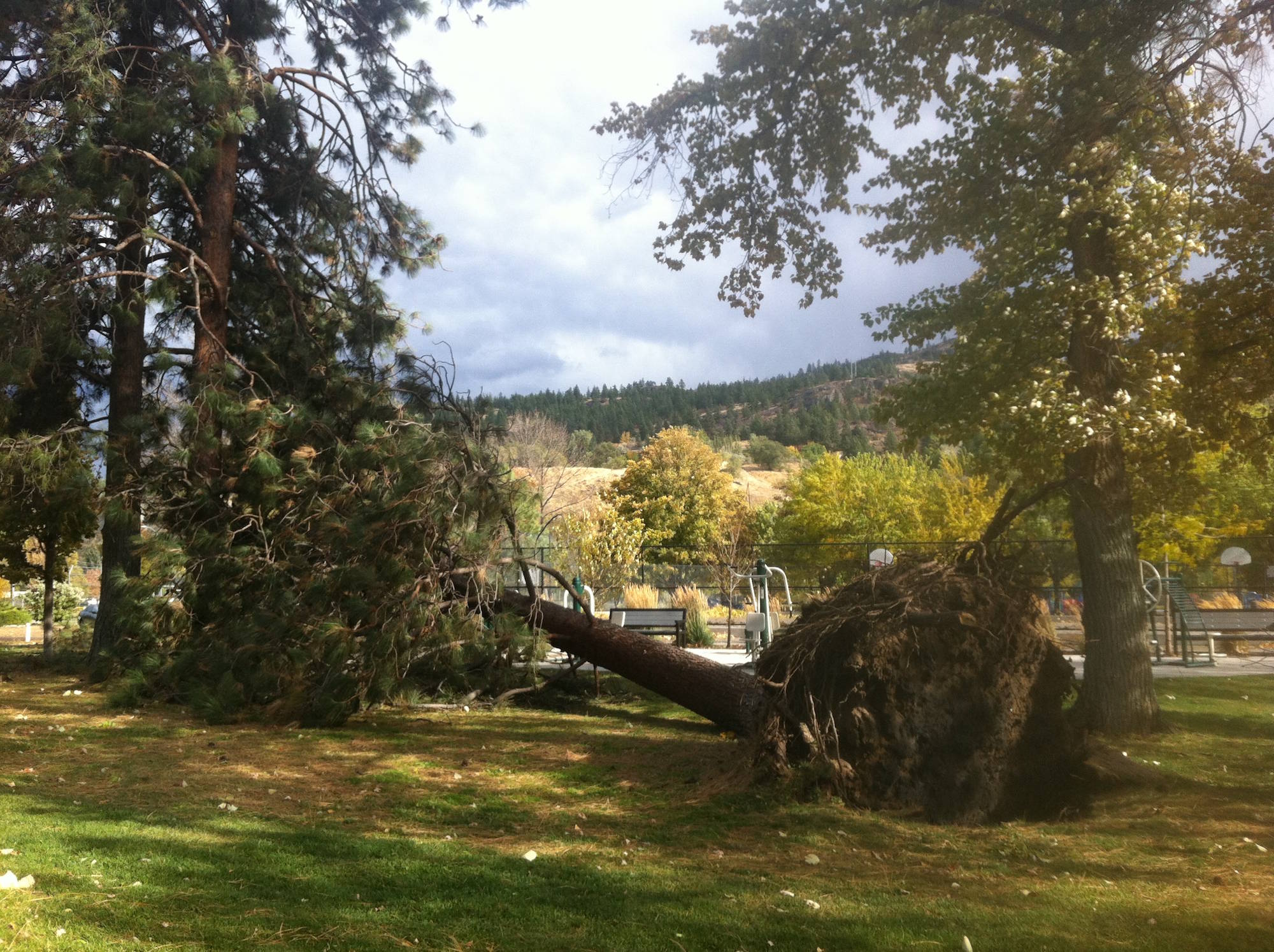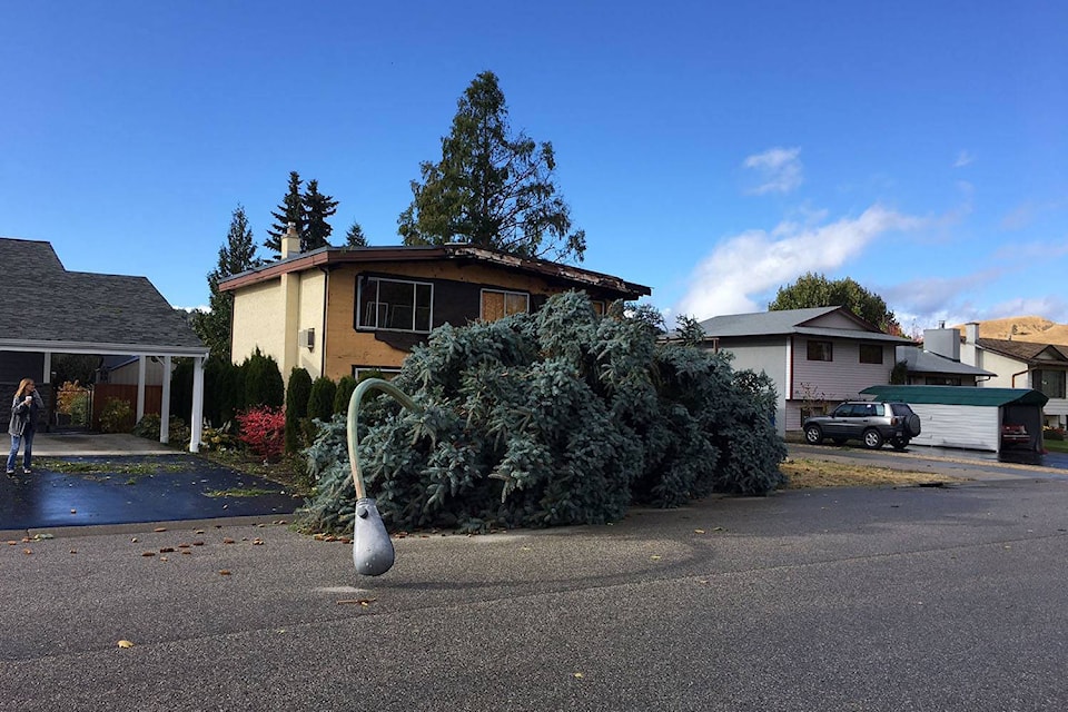
The winds have calmed throughout the Central Interior today as residents throughout the region start to clean up the mess.
Environment Canada meteorologist Doug Lundquist said winds were recorded at more than 100 km/h Tuesday in the region.
“We had gusts to 95 km/h in Penticton and 91���Ѽ at the airport. In Kamloops we hit 104 km/h and our little volunteer weather station in Vernon recorded gusts up to 111 km/h. Really significant winds,” said Lundquist.
“Those gusts in Kamloops, for example, have only happened about a dozen times in the last sixty years, so really rare.”
Gust of 102km/h in yest. was not a record (rec. is 137km/h 03-03-1975) Still rare w/ >100km/h 15 times in last 60yrs
— ECCC Weather BC (@ECCCWeatherBC)
Related:
Lundquist said the extensive damage was anticipated given the historical winds.
“It was a very significant day, we had a low-pressure system track across our area and develop as it moved across the Interior. That is unusual and doesn’t happen very often, that is why we had that severe wind.”
While there was some snow in high terrains and rain in the valley bottom, the only really notable thing about yesterday’s storm was the wind.
Related:
As for Wednesday, more winds are expected, but Lundquist said residents don’t need worry.
“Today’s storm could have winds of maybe 50, gusting to 70 km/h, but more likely in the South Okanagan near Penticton, not as much in 91���Ѽ and Vernon, but way less then we saw yesterday,” said Lundquist.
The weather pattern is such that we will be hit with a series of smaller storms over the next few days.
Another system is set to hit the region Friday and Saturday bringing further winds and heavy rain.
“What we had yesterday for a wind event was extraordinary, the storms for the rest of the week don’t look as severe,” said Lundquist.
“There should be some sun out on Thursday for part of the day and then Saturday looks like the wettest day.”
Related:
Next week the region will get a bit of a break with a building ridge of high pressure. This is good news for those who hate the cold, but bad news for local mountains.
“This means warm weather over the high terrain, it could mean one of those days where it is actually warmer in the plateau than in the valley bottom,” said Lundquist.
“Unfortunately any snow in the ski hills will likely melt next week.”
Related:
Check out the summary of peak winds observed in the Interior for the Oct. 17, 2017 storm:
- Clinton: 56 km/h
- Cranbrook: 76 km/h
- Creston: 56 km/h
- Kamloops: 104 km/h
- 91���Ѽ: 94 km/h
- Merrit: 67 km/h
- Nakusp: 67 km/h
- Nelson: 61 km/h
- Penticton: 94 km/h
- Princeton: 59 km/h
- Revelstoke: 78 km/h
- Salmon Arm: 82 km/h
- Sparwood: 82 km/h
- Summerland: 72 km/h
carmen.weld@bpdigital.ca
Like us on and follow us on .